MabuhayTech Advances R&D on Next-Generation Digital Human Conversational Solutions

A New Era in Infrastructure Inspection: AI x Drone Engine Transforms Building Safety Through Automated Defect Detection and Intelligent Reporting
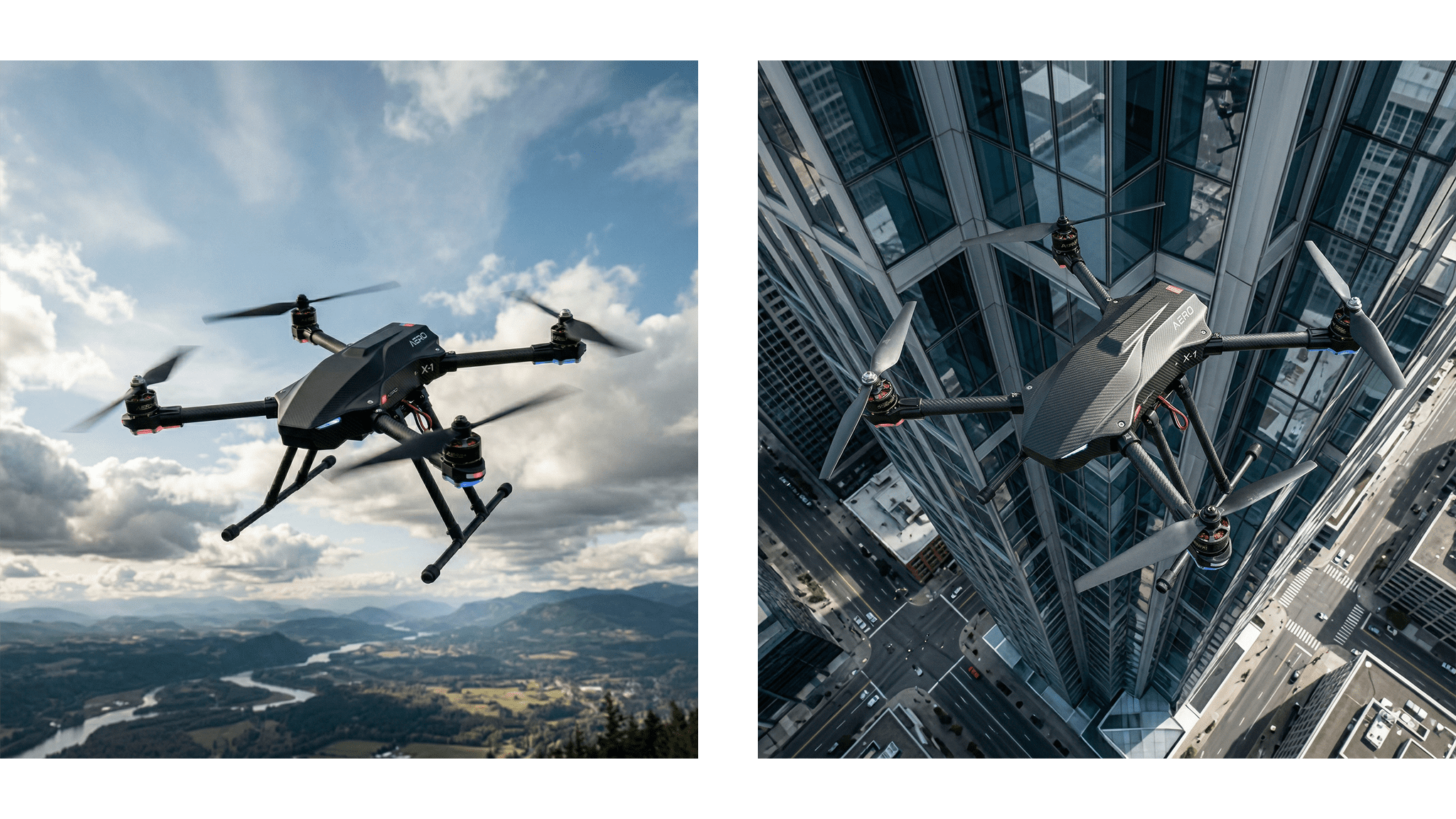
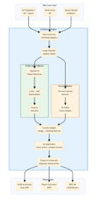
A breakthrough in construction and infrastructure technology is emerging through the AI x Drone project, an advanced inspection system designed to automate the detection, localization, and reporting of building defects using drone-captured imagery. By combining artificial intelligence with aerial data collection, the project aims to significantly improve the speed, accuracy, and scalability of building inspections while reducing reliance on manual processes.
At its core, the system leverages high-resolution visible and infrared drone images processed through an AI-powered detection engine. This engine analyzes thousands of images to identify structural issues, map them to precise building locations, and generate comprehensive inspection reports that can be integrated into existing digital workflows.
The platform introduces a robust set of features designed for real-world deployment, combining computer vision, geospatial mapping, and automated reporting into a unified pipeline. It enables faster, safer, and more data-driven decision-making for infrastructure maintenance.
Beyond its technical innovation, the AI x Drone project addresses critical social and industrial challenges by enhancing infrastructure safety and reducing inspection risks. It offers a scalable solution for maintaining aging buildings and urban environments, particularly in areas where manual inspection is costly, dangerous, or inefficient.
 The system uses a modular architecture that processes drone imagery through structured layers, from data ingestion to AI analysis and report generation. It integrates multiple components including image validation, AI detection pipelines, and location mapping to ensure accurate and reliable outputs. The architecture also supports scalability and external integration through APIs, enabling seamless deployment within existing inspection workflows.
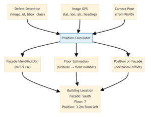 The location mapper converts detected defects from image coordinates into precise real-world positions on a building. It uses GPS data, camera metadata, and optional 3D reconstruction inputs to determine facade orientation, floor level, and exact placement. This enables inspection results to be actionable by clearly identifying where defects are located within a structure.
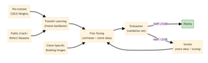 The AI models are trained using a combination of large public datasets and real-world drone imagery to ensure accuracy and adaptability. A transfer learning strategy allows the system to build on pre-trained models and refine performance through continuous fine-tuning and evaluation. Ongoing iteration, supported by data augmentation and model versioning tools, ensures the system improves over time.
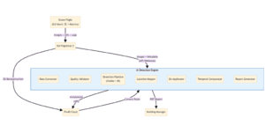 The system follows a streamlined pipeline that transforms raw drone data into actionable inspection insights. It begins with image capture and ingestion, followed by validation and AI-driven detection and analysis. The processed data is then mapped, refined, and compiled into structured reports and outputs for end users.
High-quality technical specification with strong commercial viability, especially for:
The system is designed for integration within existing drone and mapping ecosystems, utilizing APIs, cloud processing, and GPU-based AI inference. This allows organizations to implement the solution without overhauling their current workflows, making it a practical and scalable advancement toward smarter, safer infrastructure management.